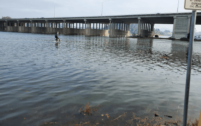
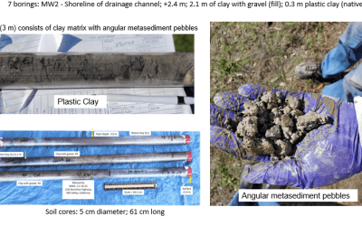
Three locations built on historically filled wetlands, or adjacent to wetlands are the locations of research for the Paytan Lab group. The study examines the groundwater response to such varied flood factors as highest astronomical tides (colloquially called “king tides”), extreme rains (atmospheric rivers), and water migration through preferential flow pathways (PFPs) to provide data for current baseline conditions for surface flooding in artificially filled wetlands.
The highest astronomical tides provide a proxy for future average tides, and the extreme rain events provide groundwater response and the potential for measuring subsurface water storage. More than a dozen groundwater monitoring wells were installed in three locations (Manzanita and Tamalpais Valley in southern Marin County, California) and Atchison Village in the City of Richmond, in Contra Costa County. The wells contain water level data loggers which record water pressure, conductivity, and temperature every 15 minutes.
Water samples have been analyzed for common anions and cations as well as stable water isotopes to better understand the source of the waters (seawater, rainwater, sewer water, irrigation water, etc.) found in different well locations. The study focuses on the water year 2022-2023 from October 1, 2022, to September 30, 2023, and the data loggers will be left in the wells to continue to collect data. This part of the study is being funded by the National Oceanic and Atmospheric Administration (NOAA) California Sea Grant. Another part of the study will focus on sea level rise (SLR) and contaminant exposure in the San Francisco Bay area, which is funded by an Ocean Protection Council Prop 68 grant. A J. Casey Moore Fund grant from the Earth and Planetary Sciences Department at the University of California Santa Cruz has also supported equipment procurement.
San Francisco Bay Research Team


